Water storage tank, Drysdale VIC
- Location
- Drysdale, Greater Geelong City, VIC, 3222, AustraliaView Drysdale image collection →
- View Type
- Aerial
- Capture Date
- 1 April 2025
- Description
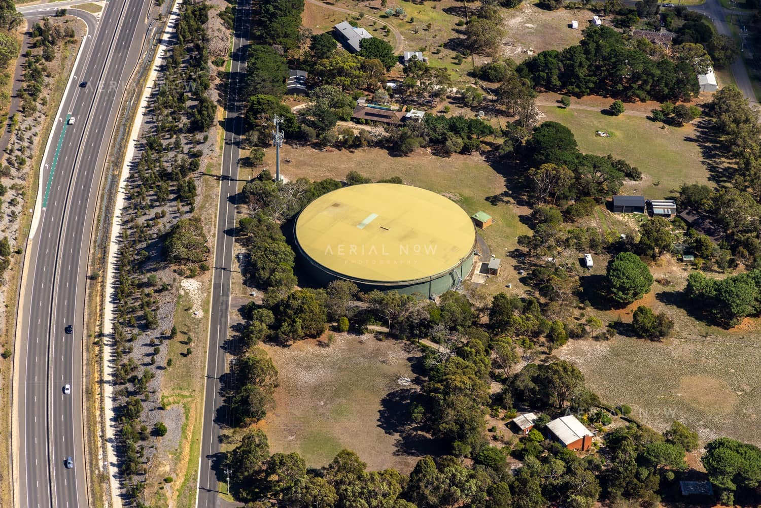
- A large circular water storage tank is shown beside Andersons Road in Drysdale on the Bellarine Peninsula. This image suits infrastructure reporting, utilities planning, land use studies, property context and commercial licensing.
Keywords
Buy and download
For websites, social posts, presentations and smaller digital placements.
For infrastructure, construction, reports, brochures and commercial marketing.
For higher visibility campaigns, print runs, signage and broader distribution.
Image ID: 36baae2b
Image Details
This high-resolution archive image captures an aerial view of a large circular water storage tank near Andersons Road in Drysdale, with surrounding rural properties, trees and adjacent road traffic. The scene is located around Drysdale, Greater Geelong City, VIC, Australia. It was captured on 1 April 2025. Visible and searchable details include water storage tank, water infrastructure, circular water tank, Drysdale, Drysdale VIC, Andersons Road. The image is suited to planning and infrastructure reports, editorial use, location research, construction communications and commercial visual reference.
Suitable Uses
At a Glance
- Image ID
- 36BAAE2B
- View Type
- Aerial
- Capture Date
- 1 April 2025
- Location
- Drysdale, Greater Geelong City, VIC, 3222, Australia
- GPS
- -38.186985, 144.570998
Historic Context
Historic water supply context
This modern aerial view sits within a much longer Drysdale water-supply story. Trove newspaper records show local concern about providing Drysdale with pure water as early as 1879, when a public meeting at the Shire Hall discussed springs, waterholes, Lake Lorne and local storage needs.
Later records connect Drysdale to the Bellarine water scheme. In February 1930, newspapers reported that funding was being made available for the Drysdale storage reservoir. By late April 1930, preliminary works were due to begin, and by September 1933 The Argus reported that both the main reservoir and the Drysdale storage reservoir had been completed.
The current covered water storage tank photographed here should be described carefully as part of Drysdale's water infrastructure, rather than assumed to be the exact 1930s structure without further asset records. Even so, the site is a strong example of how Aerial Now imagery can document present-day infrastructure while preserving the older layers of planning, public works and regional growth beneath it.
Location Map
This image is geotagged around Drysdale, Greater Geelong City, VIC, 3222, Australia. The map marker uses the embedded GPS position at -38.186985, 144.570998.
Photographer and Usage
Photograph by Aerial Now. This image is part of the Aerial Now archive and is available for commercial, editorial and project-related licensing. For construction progress, infrastructure documentation or a matching current aerial view, book a dedicated shoot through Aerial Now.
Related Images
More licensable imagery from related locations, projects and subjects.