GrainCorp Moree grain terminal, Moree NSW
- Location
- Moree, Moree, NSW, 2400, AustraliaView Moree image collection →
- View Type
- Aerial
- Capture Date
- 6 October 2005
- Description
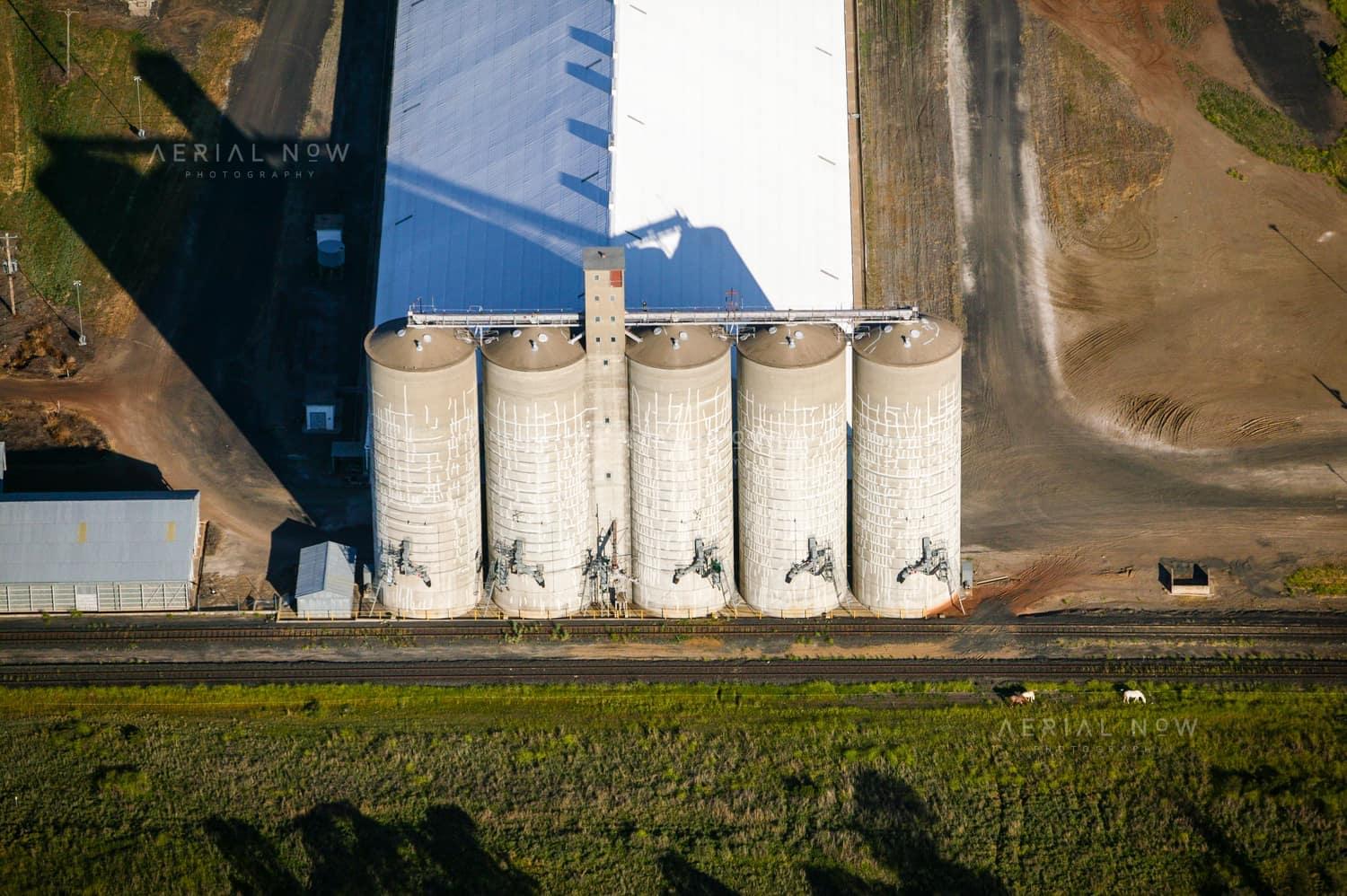
- Captured on 6 October 2005, this aerial photograph documents the GrainCorp Moree grain terminal at the Alice Street and Industrial Drive freight precinct. The Moree sub-terminal was constructed in the 1950s as part of the New South Wales bulk-grain network, establishing a rail-connected point for consolidating harvests from the surrounding grain belt. The site receives, stores, grades and dispatches grain by road or rail, including wheat, barley, chickpeas, canola and sorghum. In a strong harvest year, GrainCorp described its Moree site as one of its largest, receiving up to 600,000 tonnes. The rail corridor beside the silos is part of the Narrabri to Moree freight route, later upgraded through Inland Rail works. This image preserves the terminal in 2005, before those recent rail upgrades.
- Named Landmarks
- GrainCorp Moree, Narrabri to Moree rail corridor
Verified subjects
Buy and download
For websites, social posts, presentations and smaller digital placements.
For infrastructure, construction, reports, brochures and commercial marketing.
For higher visibility campaigns, print runs, signage and broader distribution.
Image ID: 7ae53825
Image Details
This high-resolution archive image captures an aerial view of the GrainCorp Moree grain terminal, showing concrete silos, bulk grain storage shed and rail siding in Moree, New South Wales. The scene is located around Moree, Moree, NSW, Australia. It was captured on 6 October 2005. Visible and searchable details include GrainCorp Moree, Moree grain terminal, Moree sub-terminal, grain silos, bulk grain storage, rail siding. These details document the photographed site and its surroundings at the recorded capture date.
At a Glance
- Image ID
- 7AE53825
- View Type
- Aerial
- Capture Date
- 6 October 2005
- Location
- Moree, Moree, NSW, 2400, Australia
- GPS
- -29.496783, 149.853108
Location Map
This image is geotagged around Moree, Moree, NSW, 2400, Australia. The map marker uses the embedded GPS position at -29.496783, 149.853108.
Photographer and Usage
Photograph by Aerial Now. This image is part of the Aerial Now archive and is available for commercial, editorial and project-related licensing. For construction progress, infrastructure documentation or a matching current aerial view, book a dedicated shoot through Aerial Now.
Related Images
More licensable imagery from related locations, projects and subjects.